rareoldprints.com


Search

If you know the reference number
enter it here:


If you enter more than one word
it will be treated as phrase.

Insert "and" or "or" between words to search for the words in any order.

Refine your search here or build another search.
Displaying 0 to 10 of 31 - Next -
91%
Hamp Shire and the Isle of Wight Divide into their Respective Hundreds
Ref: P/4692
Region: Hampshire
Type: Copper
Cartographer: Bowen E
Engraver: Bowen T
Publisher: E & T Bown
Date: 1767

Sold
90%
A New & Accurate Map of that part of Great Britain called Scotland (T.Bowen)
Ref: P/646
Region: Scotland
Type: Copper
Engraver: Bowen T

90%
An Accurate Map of the County of Norfolk Divided into its Hundreds.
Ref: P/12802
Region: Norfolk
Type: Copper
Cartographer: Bowen E
Engraver: Bowen E
Publisher: Printed for Messrs Bakewell & Parker and J Bowles & Son in Cornhill, T Bowles in St. Pauls Church Yard, H Overton without Newgate, T Kitchin on Holborn Hill, R Sayer & J Ryall in Fleet Street
Date: 1764

Sold
90%
Wiltshire Divided into its Hundreds
Ref: P/8021
Region: Wiltshire
Type: Copper
Cartographer: Bowen E
Engraver: Bowen E
Publisher: E & T Bowen
Date: 1767

Not for sale
89%
An Accurate Map of the Counties of Gloucester and Monmouth Divided into their Respective Hundreds
Ref: P/4769
Region: Gloucestershire
Type: Copper
Cartographer: Bowen E
Engraver: Bowen E
Publisher: T Bowles, Robt Sayer, John Bowles & Son
Date: 1760

87%
A New and Correct Map of the Countries Twenty Miles Around London, by Thos. Bowen.
Ref: P/14533
Region: London
Type: Copper
Engraver: Bowen T
Publisher: Thomas Bowen
Date: 1770

87%
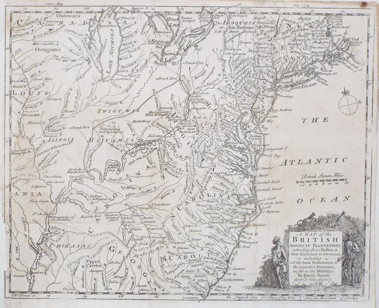
A Map of the British American Plantations extending from Boston in New England to Georgia; including all the back Settlements in the respective Provinces, as far as the Mississipi.
Ref: P/30753
Region: East Coast
Type: Copper
Cartographer: Bowen E
Engraver: Bowen T
Date: 1754

87%
Bowles's New Medium Map of Wiltshire
Ref: P/8023
Region: Wiltshire
Type: Copper
Cartographer: Bowen E
Engraver: Bowen E
Publisher: Carrington Bowles
Date: 1785

Not for sale
87%
An Improved Map of Wiltshire Divided into its Hundreds
Ref: P/8018
Region: Wiltshire
Type: Copper
Cartographer: Bowen E
Engraver: Bowen E
Publisher: Robt.Sayer & John Bennett, John Bowles & Carrington Bowles
Date: 1763

Not for sale
87%
Bowles's New Medium Map of Wiltshire
Ref: P/8020
Region: Wiltshire
Type: Copper
Cartographer: Bowen E
Engraver: Bowen E
Publisher: Bowles & Carver
Date: 1794

Not for sale

Displaying 0 to 10 of 31